Feel free to just scroll through the pictures :)
The day had finally arrived - the Bear Bones BIke Packing There 'n' Back ride was here. I'd loaded up the car the night before so, after a quick bowl of porridge I was off. It was a cracking morning with the promise of a proper bit of winter sunshine.
 |
| Loaded up & ready to go... |
I was aiming to arrive at the start, Llanbrynmair, around 9am so I was on schedule when I stopped for fuel in Llanidloes at 8:45. I'd run out of screenwash a few miles before so I topped this up too - mechanical #1! The bonnet release catch decided to jamb open so that the bonnet wouldn't close!!! Luckily I had a box full of MTB tools including a BIG can of WD40 so after 15 minutes of swearing and de-skinning a couple of knuckles it was sorted. However, I'm pleased to report that this was the only mechanical problem for the whole event so I can't really complain :)
I arrived just after 9am, signed in and was presented with my Bear Bones Bikepacking bum bag and hand warmer (better than a handbag and bum warmer I suppose?) - and a plate of toast and a mug of tea! Perfect start... After a bit of a natter with some of the other riders I unloaded the car, checked I had everything (at least twice) and headed off.
 |
| First climb of the day - Llanbrynmair in the distance |
When choosing my route I wanted to use as little road as possible so I found myself on my first bridleway within 1/4 mile. A good bridleway - a sign with a horse on, gates - just what a bridleway should be. It was a bit steep though - especially with all the gear I was carrying. It seemed like an ideal opportunity to stop and take a photo :)
 |
| Still Llanbrynmair... |
This all carried on well, with plenty more 'photo stops' until I came to a gate into a forest. My 1:25000 map was telling me to ignore the gate and climb up this incredibly steep field. My heart (my legs more specifically) thought the track into the forest looked much more fun. It seemed to be going in the right direction too. Decision made I slipped through the gate and was soon enjoying a nice bit of singletrack through the forest which broke out into a great descent - heading straight back to Llanbrynmair :( After a check of the map I realised my mistake and, not for the last time, pushed my bike back up the hill - it didn't look so appealing then!
 |
| Back on the right track. |
Lesson #1 - If you have cycled to the top of a hill check your map even if you are certain which way to go before heading down. Then check it again!
 |
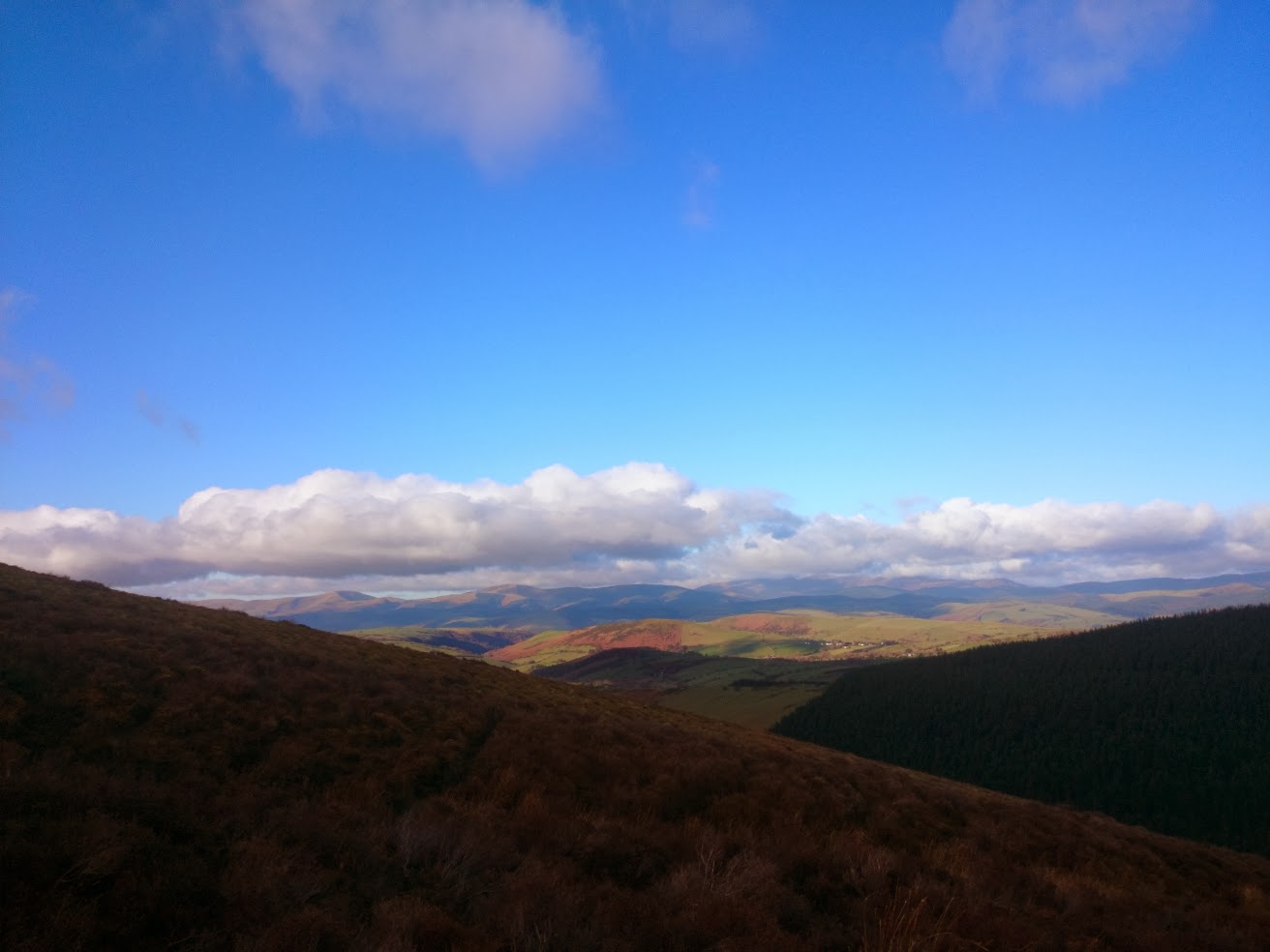
| Last look back North before dropping off the first hill |
Finally all that climbing paid off with a lovely descent down a cracking forest track past loads of uprooted trees - damage from the previous weeks storm I guess. At the bottom of the hill I came out onto a road where I met 3 riders who'd started out from Llanbrynmair about 15 minutes before! Was that descent really worth over an hours climbing???
 |
| Couldn't ask for better weather. |
Anyway, roads weren't for me (yet!) so I simply crossed to the other side straight onto another bridleway and another climb onto Waun Ty Isaf. After a lot of map checking (refer to lesson #1) I worked my way down to my first bit of tarmac - the climb up to Foel Fadian. I believe this is on a list somewhere as one of the greatest road climbs in Britain - if it isn't it should be. However, it didn't feel that 'great' on a mountain bike running Nobby Nics weighed down with all my kit... Anyway, I knew I was coming onto the climb after the start of the Strava segment so I decided not to 'go for it' - I'll leave that for another day (and another bike).
 |
| Garmin Edge 800 - Clever GPS, stupid operator. |
I use a Garmin Edge 800 loaded with OpenStreetMap which is a brilliant device. However, I didn't realise that, if I deviated from my intended course, it would automatically re-calculate my route. Of course, not all of the bridleways I was using existed wthin the map data so the new route calculated tried to use whatever tracks / roads it could. The outcome of all this was that my GPS decided I needed to drop down the other side of Foel Fadian through Dylife. A stunning tarmac descent - who was I to complain? As I started the descent I looked across at a lake and a lovely strip of double-track heading off to the SW: "I bet that'd be a good ride - some other time". Refer to lesson #1! I can confirm that the ride up onto Foel Fadian is a 'epic' from the South...
 |
| Abandoned farm at Bugeilyn - GO NORTH WEST!!!! |
Having finally warmed up my legs properly I headed SW with Nant y Moch my distant goal. The double track past Glaslyn to Bugeilyn was easy riding. At the farm this track splits and, following the mapped bridleway, I took the left fork. NOTE: I found out after the event that the right fork is a 100% rideable route all the way to Nant y Moch! Hindsight :)
 |
| The Hengwm valley |
Now, the Hengwm valley is very pretty and there are bits of track visible - occasionally! Some of it was even rideable... After a few hours of trudging through bog I noticed that there was a track indicated on the 1:25000 - on the other side of the river. I couldn't see this track but the map said it was there and anything would be better my current location. Of course this meant crossing the river - we haven't had much rain lately have we? 'Luckily' I was already soaked up past my knees so wading across the Hengwm just cleaned some of the mud off :)
Was it worth it? No! The 'track' was even boggier than the bog I'd left on the other bank... Eventually I met the proper track at the confluence of the Hengwm and the Hyddgen. Rock & stone laid down in a long line - how exciting :)
 |
| Highland cattle at Nant y Moch |
After a while this track led onto the Nant y Moch road that winds around the reservoir. Flat(ish), smooth tarmac - joy! I may have been suffering the effects of exposure & exhaustion at this point as I came across a herd of Highland cattle and sang them a whole chorus (well, the bit I remembered) of James Blunt's "You're beautiful".
 |
| Nant y Moch looking East |
I felt I was on my home straight now. I've ridden the Syfydrin a few times so I was confident I knew where I was going. The sun was setting ahead of me and I had enough light to carry on without getting the bike lights out.
 |
| Syfydrin trail - nearly in Aberystwyth :) |
Back on tarmac I headed straight for Bow Street, stopping at the Spar for a couple of chocolate bars, and then on to Aberystwyth. I'd always intended on getting fish & chips and sitting on the sea front watching the sun go down. As I'd missed that by about 45 minutes I decided to head somewhere where I could sit in the warm, have a hot cup of tea and FOOD! I make no apologies for that place being McDonalds...
 |
| I was very happy (and trying hard not to think about the night to come) |
It was warm in there, there were people, the TV was on.....I didn't want to leave. I'd noticed that the dry bag slung across my handlebars had developed a nice icy frosting over the last hour or so - it was going to be a cold night.
I eventually prised myself away from that glorious sanctuary (never thought I'd call it that!) and headed through Aberystwyth (via a couple more Spars) to the Ystwyth Trail - a traffic free cycling route. It was dark and cold now but I wanted to keep cycling until I was ready for bed - not much else to do after all! From 9pm I started looking for somewhere suitable to set up camp, finally spotting the perfect site around 9:30. Conifer forest, dry bracken floor, en suite facilities - what more could you ask?
 |
| Home, sweet home? |
Now came the delicate choreography of stripping out of all of the cold, wet cycling gear and getting into my dry thermals (no pictures you'll be pleased to know). Once I was settled in my sleeping bag I got the stove lit for a hot bedtime drink.
All in all I had a good night's sleep. I did wake up a few times with a cold face but the sleeping bag / bivvy bag worked really well. At 2:30 a car did pull into a nearby car park - lots of door slamming and shouting before they drove off at speed! I didn't check for bodies in the morning...
 |
| It was a cold one... |
I woke at 7am and quicky realised that all of my cycling clothes were frozen where I'd hung them to 'dry' :( The thought of a frozen chamois cradling my nethers kept me in my sleeping bag a while longer....
In the end I kept that 'treat' until the last possible minute, packing up everything else first. I managed a hot drink - just - before the gas stove decided it was too cold and stopped working. Meths next time.
 |
| The Ystwyth near Pont-rhyd-y-groes |
From my camp site I used the Ystwyth Trail and then roads until I'd climbed up to the Teifi Pools. The climb was fun - sheet ice right across the road in places made forward progress challenging at times.
 |
| Teifi Pools looking West |
The plan was to follow the track until I came to the fork* where I could cut across East toward Rhayader - the infamous Monk's Trod. Although I didn't know it was Monk's Trod until I came across a marker post floating in the bog....
*Note: Stay on the track here and go down to Claerwen for a rideable route to Rhayader! Hindsight - again!
 |
| Looking towards the Tywi Forest |
Now, recapping back to last night I'd bought a few chocolate bars - most of which I ate at bedtime. Added to my depleted stock of energy gels (singular) and some sugar-free chewing gum this left me woefully short of supplies for my trek across to Rhayader. Bonking is a terrible experience at any time (please check the link!) but when you are miles from anywhere, knee deep in a mountain bog with a biting wind throwing rain/sleet in your face - well, let's just say it was character building :)
Lesson #2 - Always pack enough food for your planned journey - and then pack the same again!
Eventually I made the road at the top of Craig Goch Reservoir - and another huge hill to climb before rolling down into Rhayader. I'd always planned on taking the 'Golf Links' descent but I'll have to save that for another day. A quick stop into the Spar for a can of coke and two Cadbury's Creme Eggs (I'd been fantasising about this for the last few hours) and my next stop was a cafe. I parked myself against a radiator, downed 3 mugs of sugary tea and awaited my burger and chips, shivering uncontrollably and getting some funny looks from the other customers.
You'll be pleased to know that my wittering drivel is almost over. I had planned to ride up through Hafren Forest but it was dark, I was cold, it was raining and I just wanted to get back to my car (heated seats, dry clothes) Consequently I just rode up the A470 to Llangurig, across to Llanidloes and then up the B4518 to Llanbrynmair. I briefly stopped at a garage in Llanidloes to refuel on coke and chocolate and chatted to the guy behind the counter:
Evil shopkeeper*: "Where are you headed?"
Me: "Llanbrynmair"
Evil shopkeeper: "Really? There's some wicked hills on that road. They use it on the Tour of Britain you know"
Me: "Oh......"
*He was probably really nice
They were wicked hills but they were between me and my car so I plodded on. I walked up a couple, rode a few and eventually the streetlights of Llanbrynmair came into view....
Stu and Dee were still there and a hot cup of tea and a huge slice of homemade cake were soon consumed - perfect.
Here's the Strava link: http://www.strava.com/activities/105951568
It is only 24 hours after the event finished and I'm already looking forward to the next event - in May this time!


That is quite some tale, I noticed there were a couple of sprouts off your track log on Strava and knew you'd probably errored - my heart sank for you!! :-/
ReplyDeleteThanks Andy! The worst was on the Monk's Trod - If I'd had a phone signal I may have called the Samaritans or Mountain Rescue... :)
ReplyDelete